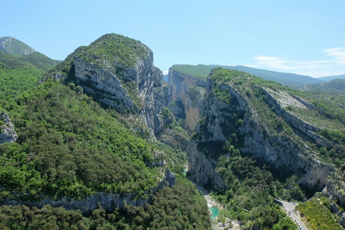
Hiking in Haut-Languedoc: Complete Guide to the Natural Park
The Haut-Languedoc Regional Natural Park is one of the best-kept secrets of the Massif Central. Nestled between the Tarn and Hérault departments, less than two hours from Montpellier and Toulouse, it attracts far fewer visitors than the neighbouring Cévennes — and that's precisely what makes it one of the most precious hiking territories in southern France. Ancient beech forests, otherworldly granite boulder fields, canyons carved vertically into basalt: Haut-Languedoc offers landscapes that rival any of its more famous neighbours.
The park also has a rare geographical feature: it sits on the climate divide between the Atlantic oceanic climate and the Mediterranean climate. Within just a few kilometres of walking, you can cross from moss-covered humid forests to dry garrigue scented with thyme, from windswept ridges to sheltered hollows where chestnut trees still grow. This climatic duality produces strikingly contrasted landscapes and exceptional biodiversity for the latitude.
Here is our guide to the 7 most beautiful hikes in Haut-Languedoc, from the Héric gorges to the Sidobre, from Lake Laouzas to the beech forests of the Écarts.
A Park Straddling Two Climates
The Haut-Languedoc Regional Natural Park covers 257,000 hectares across two departments. It is traversed by the watershed divide between the Atlantic basin (Tarn side, flowing to the Atlantic via the Garonne) and the Mediterranean basin (Hérault and Orb side, flowing to the Mediterranean). This invisible boundary, running along the ridges of the Montagne Noire and the Caroux massif, is responsible for everything.
On the Atlantic side, rainfall is spread throughout the year, forests are dense, and streams flow year-round. On the Mediterranean side, rain falls in violent episodes — the famous Cévennes flash floods — and summers are dry, with drought-adapted vegetation. The meeting of these two regimes creates microclimates where species that are normally incompatible coexist: beech trees (temperate humid European species) alongside kermes oaks and cistus (Mediterranean garrigue).
For hikers, this means a unique experience: in the same day, you can cross a misty beech forest with the smell of undergrowth, emerge onto a windswept plateau, then descend into a canyon basking in Mediterranean sun. Pack layers for significant temperature swings — the difference between north- and south-facing slopes can exceed 10°C within an hour's walk.
The Héric Gorges and the Caroux Massif
1. The Héric Gorges: The Park's Flagship Hike
View the OpenRando trail — Pas d'Héric loop — 7.6 km, 29 m elevation gain
The Héric gorges are the most photogenic hike in Haut-Languedoc. The Héric torrent, tumbling down from the Caroux plateau, has carved over millennia a deep gorge through granite, studded with natural pools of emerald water perfect for swimming from June to September. The trail follows the stream for its entire length, sometimes carved into the cliff face, sometimes crossing wooden footbridges above the rapids.
The hike starts at Douch or the village of Mons-la-Trivalle. The path climbs the gorge over 7.6 km as an out-and-back, with very modest elevation gain — making it accessible to families. In autumn, ferns turn russet and plane trees shed their leaves into the stream: the atmosphere is less crowded than summer, and wilder.
Level: easy | Duration: 2-3 h | Start: Pas de l'Escalette car park or Mons-la-Trivalle
2. The Caroux Summit and Its Vultures
The Caroux plateau (1,091 m) is the highest point of the massif. You reach it from Douch via a trail that climbs through dense beech forest before emerging onto the windswept plateau. The reward: a 360° panorama over the Mediterranean plains on one side, and the first foothills of the Massif Central on the other.
The Caroux is also the site of the reintroduction of Corsican mouflon in the 1950s. The colony, now numbering several hundred animals, is visible on the rocky slopes of the plateau, particularly in early morning. To maximise your chances of observation, read our guide to watching wildlife on hikes without disturbing the animals.
Compact binoculars are essential for spotting mouflon and the griffon vultures that soar on Caroux's thermals around midday.
Level: intermediate | Duration: 4-5 h return | Start: village of Douch
3. Héric Via Ferrata (Sporty Variant)
For thrill-seekers, the Héric gorges area offers several rock climbing routes and a via ferrata. The Héric via ferrata overlooks the gorge from an exposed ledge, with passages through granite cracks and zip lines across the torrent. This variant requires appropriate equipment: a complete via ferrata kit and approach shoes.
The Sidobre and Its Granite Boulders
4. The Sidobre Chaos: An Otherworldly Landscape
The Sidobre, east of Castres, is one of the strangest geological phenomena in France. This 12 km² granite plateau is covered with a chaos of rocks in improbable shapes: granite blocks weighing several tens of tonnes, rounded by chemical weathering, stacked in equilibria that seem to defy the laws of physics. Some blocks have been given evocative names: the Peyro Clabado ("nailed stone"), which balances on a support just centimetres wide; the Roc de l'Oie; the Trois Fromages.
The Sidobre hiking trail loops around the main sites over 8 to 12 km depending on the variant chosen. The oak and pine forest surrounding the rocks is particularly beautiful in autumn. The trail is marked in yellow and accessible to most levels — bring shoes with good grip for crossing the boulder fields.
Level: easy to intermediate | Duration: 3-4 h | Start: Peyro Clabado car park (Burlats or Ferrières)
5. The Agout River and the Dourbie Springs
Descending from the Sidobre toward the Tarn, the Agout river traces a green valley between rolling hillsides. The trail following its banks from Brassac to the Dourbie springs crosses a mosaic of meadows, riparian forest and old mills. In autumn, the alluvial forest is of exceptional beauty: alders, ash and willows turn yellow and gold in a mix reminiscent of the Quercy river bottoms.
This hike is especially suitable for families and walkers seeking a gentle day with no significant elevation gain, through a typically Languedocian landscape.
Level: easy | Duration: 3-4 h | Start: Brassac (Tarn)
Lake Laouzas
6. Circuit Around Lake Laouzas
Lake Laouzas is one of the largest reservoirs in the Massif Central. Perched at 800 m altitude on the Montagne Noire plateau, it offers a mountain lake landscape that surprises visitors who weren't expecting it this far south. The circuit around the lake (approximately 20 km) is a full day's hike easily split into two stages. In autumn, the conifer and deciduous forests framing the lake turn shades of brown and ochre, and morning mist on the water creates remarkable photographic atmospheres.
The lake is also the starting point for hikes to the Montagne Noire ridgelines, whose summits offer unobstructed views over the Languedoc plain and, on clear days, the Pyrenees.
Level: easy to intermediate | Duration: 5-6 h (full circuit) | Start: Laouzas dam (Nages)
The Grande Draille du Languedoc
7. The Grande Draille: Walking in the Footsteps of Drovers
View the OpenRando trail — Grande Draille du Languedoc — 9.9 km, 120 m elevation gain
The Grande Draille du Languedoc is one of the oldest paths in France. This transhumance route, used since Antiquity by millions of sheep migrating between the Mediterranean lowlands in winter and the upland pastures of the Cévennes and Massif Central in summer, crosses Haut-Languedoc from southwest to northeast for over 250 km. Some sections are 40 to 80 metres wide — the width needed to pass a flock of several thousand head.
The section from Saint-Laurent-de-Muret is one of the most accessible and best-preserved. The draille climbs gently through meadows and gorse heath, with open views over the surrounding valleys. In October, the last transhumance flocks of autumn still pass through — a pastoral scene unchanged for centuries.
Level: easy | Duration: 2.5-3 h | Start: Saint-Laurent-de-Muret
Mouflon and Raptors: Where to Spot Wildlife in Haut-Languedoc
Haut-Languedoc is exceptional for wildlife watching, particularly in autumn. The deer rut and mouflon mating season both occur from late September to mid-October — the best time of year to observe them.
Corsican mouflon: Caroux plateau, north-facing slopes between Douch and Rosis. Look for them early morning on sunny rocky couloirs. Keep your distance (minimum 200 m) and use binoculars or a spotting scope.
Griffon vultures: the Caroux massif hosts a griffon vulture colony reintroduced in the 1990s. They soar on thermals between 10am and 4pm, particularly active in moderate winds. The cliffs above the Héric gorges are the best observation point.
Bearded vulture (Lammergeier): a few individuals have been reported in the area following recolonisation from the Pyrenees. Their 2.80 m wingspan makes them unmistakable.
Red deer: the forests of the Montagne Noire and Caroux slopes hold a significant red deer population. The rut can be heard at dusk and dawn in October. Refer to our full guide on watching wildlife on hikes without disturbing the animals.
Planning Your Hike in Haut-Languedoc
Getting there: the park is accessible from Béziers (60 km), Montpellier (80 km), Castres (20 km) and Toulouse (90 km). Most trailheads have free car parks.
Best season: spring (April-June) for wildflowers and swollen torrents, autumn (September-November) for colours and wildlife. Summer is hot on the Mediterranean-facing slopes, but the gorges stay cool.
Gear: temperatures can drop quickly at altitude. Always bring a waterproof rain jacket and enough water — springs are rare on the plateaus.
Maps: IGN 1:25,000 maps cover the park across several sheets (2443ET, 2444ET, 2543ET). The OpenRando app offers downloadable GPS tracks for each hike described here — explore all Haut-Languedoc hikes.
As an Amazon Associate, we earn from qualifying purchases. Links marked with an external icon are affiliate links.
Related reading
Hiking in the Monts de Vaucluse: Gorges, Bories and Lavender Plateaus
Seven hikes in the Monts de Vaucluse: combes, bories, faded lavender plateaus and perched villages between Sault and Gordes.
Hiking the Ardèche Gorges: 8 unmissable trails
Discover 8 spectacular hikes in the Ardèche gorges and wild landscapes: volcanoes, canyons, medieval villages and breathtaking panoramas.
Hiking During Hunting Season: How to Stay Safe in Autumn
How to hike safely during hunting season in France: know the hunting dates by region, how to spot an active drive hunt, how to stay visible, and what to do if you encounter a battue.