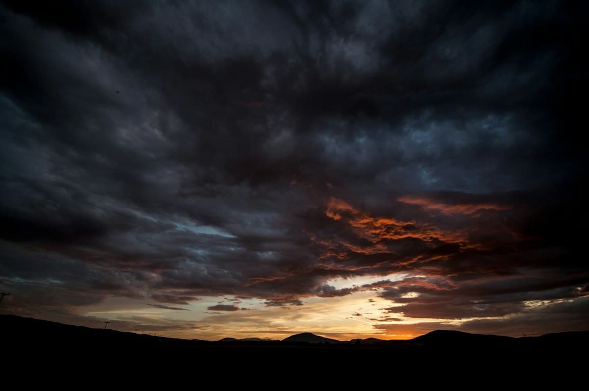
Reading Mountain Weather: Clouds, Wind, and Storms Without an App
The morning forecast says "risk of afternoon showers above 1,500 metres." Three hours later, you're at 2,000 metres and the sky has turned steel grey. Your phone has no signal. What exactly is happening above your head?
Reading mountain weather without a screen is a skill every hiker can develop. It won't replace a professional forecast — but it gives you the critical minutes to turn back before a storm breaks.
Why the Forecast Alone Isn't Enough
Standard weather predictions are built for lowlands, often covering an entire region. In the mountains, terrain creates microclimates that models miss: one slope can stay sunny while a nearby valley takes a downpour, and a thunderstorm can form within 45 minutes from an innocuous-looking cumulus cloud.
Mountain-specific bulletins are more precise, distinguishing altitude bands and massifs by time of day. But even they can't predict the local thermal storm that builds on a hot afternoon. This is where direct observation takes over.
Three variables to monitor continuously: clouds, wind, and atmospheric pressure.
Storm-Warning Clouds
Storms don't appear from nothing. They move through visible stages — if you know what to look for.
Cirrus: the first warning
Cirrus are the wispy white filaments high in the sky (above 6,000 m). Alone, they mean little. But if they multiply and merge into a milky veil that progressively covers the sky, it's a classic sign of an approaching disturbance within 24 to 48 hours.
Altostratus and altocumulus: confirmation
After cirrus, if you see a grey-white sheet obscuring the sky at mid-altitude (2,000–6,000 m), you're looking at altostratus. The sun appears blurry, with no sharp shadows on the ground. Rain may begin within 12 hours.
Altocumulus look like pebbles or small fleecy patches arranged in rows. An altocumulus-covered sky in the morning, combined with rising heat, often announces afternoon thunderstorms.
Cumulonimbus: the direct threat
The cumulonimbus is the quintessential storm cloud. It begins as an ordinary cumulus (white, well-defined, flat base) and grows vertically in a dramatic pillar. Its top develops a characteristic anvil shape when it reaches the tropopause (around 10,000 m in summer).
A practical rule: if a cumulus exceeds its own width in height within an hour, it is towering. This active cumulus will likely become a thunderstorm by early afternoon if it continues to grow.
Fair-Weather Cumulus vs. Towering Cumulus
Not every cumulus is dangerous. Mid-morning development is normal — these clouds simply show that warm air is rising from the surface. The question is: are they growing?
Fair-weather cumulus: base around 1,500–2,000 m, well-defined stable top, little apparent vertical movement. They may persist all day without changing.
Developing cumulus: base darkening slightly, top climbing visibly and losing sharp definition, a "cauliflower" or "broccoli" look on top. If you see this, start counting: a thunderstorm is possible in 1 to 3 hours.
Thumb rule: hold your thumb at arm's length toward the cloud. If the cloud is wider than your thumb and is rising faster than it spreads, treat it as a warning.
A barometric altimeter watch is a valuable tool here: a pressure drop of more than 3 hPa in 3 hours is a strong signal of imminent weather deterioration.
Reading Wind and Direction Changes
Mountain wind tells a story. Two shifts are particularly significant.
Wind rotation
Westerly to north-westerly winds generally accompany fair weather or clearing conditions. A wind shifting toward the south or south-west often signals an approaching disturbance, especially if it strengthens.
Watch treetops or tall grasses, or wet your finger and hold it up. A sudden reversal in wind direction in the mountains — especially with gusts — often precedes a storm by 30 to 60 minutes.
The dying wind
One of the most deceptive signs: just before a storm, the wind may drop completely. This apparent calm, combined with oppressive heat and swelling cumulus, is actually the prelude to the storm. Don't mistake it for a lasting lull.
Conversely, a steady valley breeze — upslope in the morning, downslope in the evening — is a reassuring sign under high-pressure conditions.
Counting Seconds Between Lightning and Thunder
The storm has arrived. You see a flash. Count the seconds until the thunder, then divide by 3 — that's the distance in kilometres.
- 9 seconds → 3 km: you're in the danger zone
- 6 seconds → 2 km: seek shelter immediately
- 3 seconds → 1 km: the storm is directly overhead
If the interval shrinks between two flashes, the storm is approaching. If it grows, it's moving away.
The 30/30 rule: if the gap between lightning and thunder is under 30 seconds, find shelter. Wait 30 minutes after the last thunderclap before resuming your hike. This is the standard recommendation from meteorological services and mountain guides alike.
What to Do When a Storm Hits
Lightning in the mountains is a real but avoidable risk if you act early. Here's the protocol.
Finding the right shelter
Do:
- Descend below the treeline if you're on a ridge or exposed plateau
- Move into a dip or hollow — never a stream bed, which may flash-flood
- Enter a building, chalet, or vehicle
- In forest, stay well away from isolated tall trees and prefer a clump of low shrubs
Never:
- Ridges, summits, exposed passes
- Isolated or tall trees
- Cables, fences, antennas, pylons
- Caves and rock overhangs (step-voltage risk)
- Lying flat on the ground — a popular myth that actually increases your ground contact surface
The safety crouch
If you're caught in open terrain with no shelter: crouch on the balls of your feet, feet together, arms crossed on your knees and head down. This minimises your height, reduces ground contact and limits step-voltage exposure. Do not lie flat.
Keep an emergency survival blanket in your pack — it also protects against the ice-cold wind and rain that typically accompany a mountain storm, and can prevent rapid hypothermia at altitude.
Spread out your group
If you're hiking with others, space yourselves at least 15–20 metres apart to reduce the risk of multiple people being struck simultaneously.
Anticipate Rather Than React: The Early Start Rule
The mountains reward early risers. Thermal storms in summer form mostly between 1 p.m. and 5 p.m., once heat has charged the atmosphere sufficiently. Leaving at 5–6 a.m., reaching the summit by 9–10 a.m. and descending before noon is the classic alpine schedule, applicable to most major summer hikes.
If you start late and warning signs accumulate — cirrus spreading, cumulus towering, barometer falling — don't hesitate to turn back. A summit will still be there another day; a misjudgement in the face of lightning may not be forgivable.
Be Ready for Any Scenario
A reliable waterproof Gore-Tex jacket is essential even when the forecast looks good: conditions in the mountains can shift in 20 minutes. Look for taped seams and an adjustable hood, packed light in the bottom of your bag.
On OpenRando, you can filter hikes by difficulty and area to choose routes with quick descent options in case of bad weather. Browse our Explore section to find trails matched to your level and the day's forecast.
If you're new to mountain safety, our guide Hiking Safely: Mistakes to Avoid covers the other classic pitfalls beyond weather.
Reading mountain weather is a progressive skill. The first habit is simple: look up at the sky every 20 to 30 minutes, notice whether clouds are changing shape or size, and decide before you're in an emergency. With a little practice, you'll be reading the signals the sky sends you well before any weather app has loaded.
As an Amazon Associate, we earn from qualifying purchases. Links marked with an external icon are affiliate links.
Related reading
Hiking After Rain: Muddy Trails and Flooded Streams
Hiking after heavy rain: how to assess trail conditions, safely cross a flooded stream, and know when to turn back.
Hiking in the Rain: Tips and Essential Gear
Rain doesn't have to mean turning back. Discover all the tips and essential equipment for hiking in the rain safely — and enjoy the trails from a whole new perspective.

How to Prepare for Your First Mountain Hike
Gear, training, weather, and route planning: everything you need to know to successfully complete your first mountain hike safely and make the most of the experience.