Tarn Gorges in 3 Days: Rim Trails and River Bottom Hiking Itinerary
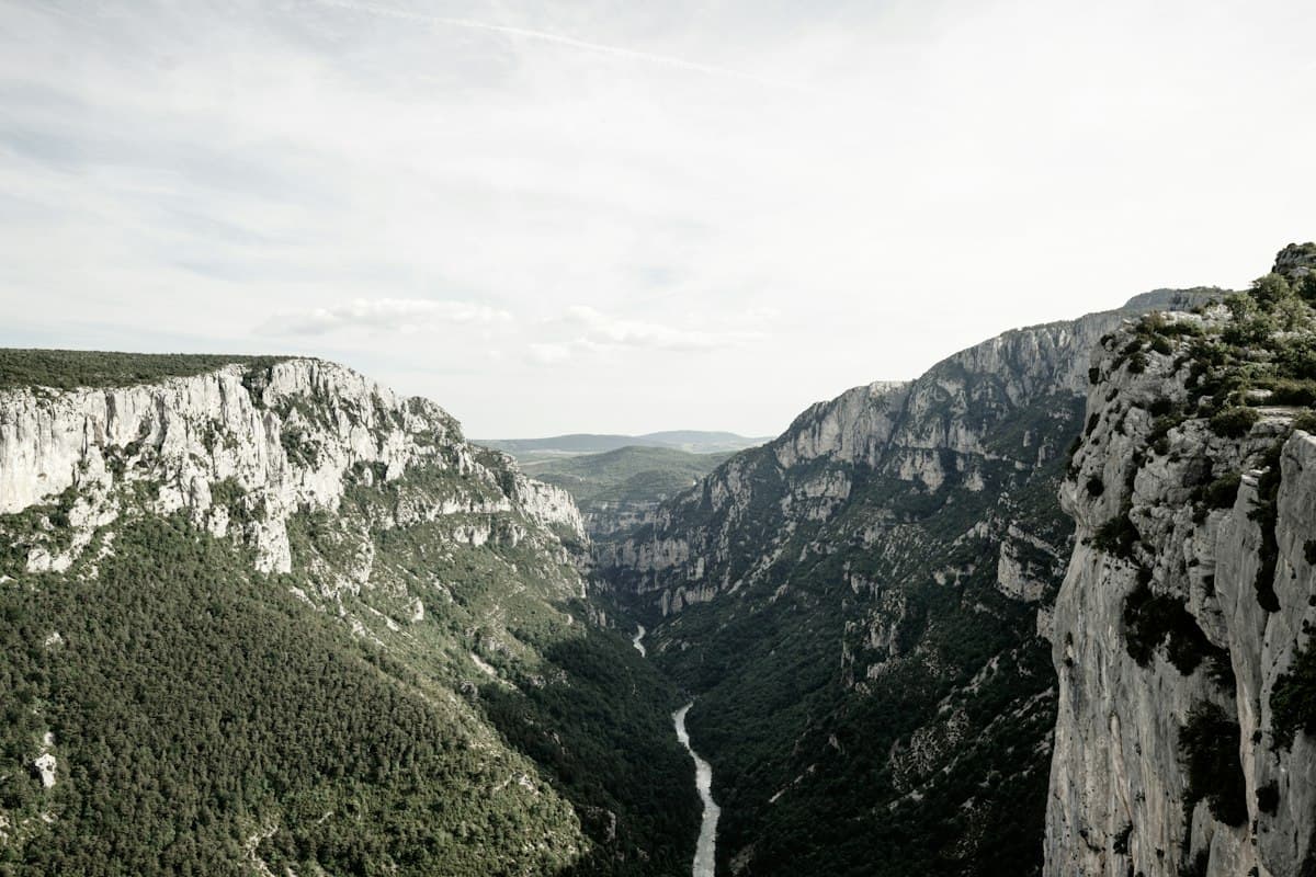
The Tarn Gorges rank among the most spectacular landscapes in France. One hundred and forty kilometres of limestone cliffs, perched villages and green water winding between rocks. Yet few hikers know it's possible to walk through them in three days, alternating between high cliff-top rim trails and the river bottom, for a constantly changing landscape.
This 55 km itinerary, suited to intermediate-to-experienced hikers, links Sainte-Énimie to the Point Sublime via La Malène — one of the finest gorge-to-gorge routes in the French Massif Central.
Rim Trails or River Bottom: the Defining Choice
The Tarn Gorges offer two radically different types of paths, and the beauty of this itinerary lies precisely in their alternation.
The river bottom (GR 6 trail, running alongside road D907 bis) follows the river. The atmosphere is cool, humid, and full of sound. You walk between cliffs and fast water, glimpse flat-bottomed boats (barques plates) on the current, and pass through hamlets pinned against the rock. Elevation gain is minimal, but summer heat can be trapping as the walls retain warmth.
The rim trails (Sentier des Corniches, GR 6A) travel 400–500 m above the gorge floor, across the causses (limestone plateaux). The viewpoints are vertiginous, the wind often blows, and the calcareous vegetation — junipers, downy oaks, lavender — creates a very different atmosphere. The effort is greater.
Our three-day itinerary combines both: river bottom on day one, rim trails on day two, and a final day alternating between the two to reach the Point Sublime, the region's most celebrated viewpoint.
Before You Leave: Logistics and Preparation
Getting to Sainte-Énimie
Sainte-Énimie is accessible by car from Mende (50 km, N88 then D907 bis) or from Millau (60 km, A75 then D907). No nearby train station: plan a carpool or shuttle.
Park at the free car park at the village entrance (Ispagnac side). Sainte-Énimie is listed among the Plus Beaux Villages de France (Most Beautiful Villages in France) — arrive early to explore before setting off.
Required Level and Equipment
This itinerary suits intermediate to experienced hikers:
- 55 km over 3 days (18 km/day on average)
- Total cumulative elevation gain: approximately 1,800 m
- Exposed sections on the rim trails (windy in off-season)
Footwear is the most critical piece of kit: the river bottom mixes wet rocks, stream crossings and muddy paths, while the rim trails demand a firm sole on limestone. Choose mid-cut waterproof hiking shoes that handle both ankle stability on scree and grip on slippery surfaces.
For hydration, water points are rare on the rim trails: carry at least 2 litres and a filtering water bottle to use the marked springs.
Accommodation Along the Route
- Sainte-Énimie: gîtes, hotels, camping (many options)
- Saint-Chély-du-Tarn: village gîte (reservation required, 12 places, +33 4 66 44 62 61)
- La Malène: youth hostel and hotels on the Tarn riverbank
Book well ahead in July–August. In September, availability is better and the gorges far less crowded.
Day 1: Sainte-Énimie → Saint-Chély-du-Tarn (River Bottom)
Distance: 16 km | Elevation: +250 m / -180 m | Duration: 4h30 to 5h
The first day follows the Tarn along its entire length on the river bottom path. It's the easiest of the three and ideal for soaking up the gorge atmosphere.
Sainte-Énimie — Le Château (5 km)
Leave Sainte-Énimie via GR 6 heading upstream. The trail alternates between the riverbank and short climbs that bypass the cliffs. You pass under the ruins of Castelviel castle, perched 200 m above the river, then cross the hamlet of Prades over an old stone bridge.
Le Château — Montbrun (6 km)
The Tarn widens slightly. The gorge remains deep but opens intermittently onto wide gravel beaches where wild camping is permitted outside July–August (check current regulations). Montbrun is a near-abandoned hamlet whose limestone houses seem to melt into the cliff face.
Montbrun — Saint-Chély-du-Tarn (5 km)
The final gorge-bottom stretch before the night stop. Saint-Chély is a hidden gem: a dozen stone houses, a Romanesque church and a spring that jets directly from a cave in the cliff — the Saint-Chély resurgence, particularly impressive after rain.
Swimming spot: the gravel beach upstream from Saint-Chély is one of the most popular (and most beautiful) in the gorges. The water stays cool even in midsummer.
Day 2: Saint-Chély-du-Tarn → La Malène (Rim Trails)
Distance: 21 km | Elevation: +900 m / -850 m | Duration: 6h30 to 7h
This is the most physically demanding and most spectacular day. You leave the river bottom to climb onto the rim trails of the Causse Méjean, 600 m above the Tarn.
The Climb to the Rim (3 km, +520 m)
From Saint-Chély, a steep path climbs straight up the cliff face in a succession of switchbacks. The first hour is demanding, but the reward is immediate: reaching the plateau edge, the Tarn appears as a green-blue ribbon at the bottom of a vertiginous drop. Stop and take it in — you've earned it.
The Rim Trail (12 km)
On the Causse Méjean, the path follows the cliff edge just metres from the drop. Viewpoints come every ten minutes: villages clinging to the walls, boats drifting downstream, birds of prey circling at eye level.
Must-see viewpoints:
- Belvédère de la Barre: 180° view over a Tarn meander
- Rocher de Capluc: a limestone ridge jutting out over the void
- Roc des Hourtous: the highest natural viewpoint on the route (800 m)
Note: no drinking water on the rim between Saint-Chély and La Malène. Carry your full supply or use marked springs (check their status in summer).
The Descent to La Malène (6 km, -850 m)
The descent to La Malène winds through oak coppice. The village appears gradually, recognisable by its medieval bridge and century-old inn. La Malène is the departure point for the flat-boat descent through Les Détroits — the gorge's narrowest passages, inaccessible on foot.
Day 3: La Malène → Le Point Sublime
Distance: 18 km | Elevation: +650 m / -520 m | Duration: 5h30 to 6h
The final day combines a riverside walk through Les Détroits (the narrows) with a climb to the Point Sublime, the gorges' most iconic viewpoint.
La Malène — Les Détroits (6 km)
The wildest section of the whole route. The path follows the Tarn through passages where the cliffs close to less than 30 metres apart, cutting the gorge floor off from sunlight for much of the day. Some stretches are cut directly into the rock face; others cross fresh scree. Demanding terrain that rewards a measured pace.
Les Détroits can be reached via GR 6 from La Malène. Don't confuse this walk with the boat trip that descends them — this is a hiking route, and a very different experience.
Climbing to the Point Sublime (12 km)
After Les Détroits, the path climbs through the hamlet of Les Vignes towards the Causse Sauveterre. The ascent is gradual, offering backward views over the gorges you've just crossed. The contrast between the shadowy valley floor and the sun-drenched plateau above is striking.
The Point Sublime (alt. 878 m) is a developed viewpoint on road D995. The view spans more than 10 km of gorges in a single glance: Causse Méjean rim trails on the left, Causse de Sauveterre cliffs on the right, and the Tarn disappearing around a meander. It's the most photographed viewpoint in the Tarn Gorges — and one of the finest in France.
A car park is available at the Point Sublime if you have arranged a shuttle or second vehicle.
Swimming and Water Points
The Tarn Gorges offer many opportunities for swimming, but a few rules apply:
- Permitted areas: stick to gravel beaches downstream of villages (Sainte-Énimie, Saint-Chély, La Malène). Swimming is banned in some sections during high water.
- Current: the Tarn can run fast in May–June after snowmelt from the Cévennes. In September, levels are low and swimming is safer.
- Drinking water: natural springs are common but should be filtered. Outside villages, don't count on taps.
Shuttles and Return to the Starting Point
This is the main logistical constraint of this point-to-point itinerary.
Option 1: two cars. The simplest solution. Leave one car at the Point Sublime before dropping the other at Sainte-Énimie. On the way back, a quick shuttle between the two.
Option 2: taxi/shuttle. Taxis des Gorges du Tarn offers shuttles between Sainte-Énimie and the Point Sublime (€35–40, book the day before). Contact the Sainte-Énimie tourist office for an up-to-date list of operators.
Option 3: bicycle. Hire shops in La Malène and Sainte-Énimie offer mountain bikes. Road D907 bis runs the full length of the gorges and allows a bike return from the Point Sublime (22 km, moderate elevation).
Going Further
If the Tarn Gorges have given you a taste for canyon landscapes, extend your stay towards Mont Lozère: our guide to hiking on Mont Lozère details six itineraries in this granite massif less than two hours from the gorges. A radically different atmosphere, equally rewarding.
To the west, the Ardèche Gorges offer a more accessible alternative — less elevation gain, more marked trails — ideal for a first experience of gorge hiking in France.
Happy hiking in the Tarn Gorges.
As an Amazon Associate, we earn from qualifying purchases. Links marked with an external icon are affiliate links.
Related reading
Best Hikes in the Aubrac: Pastures, Burons and the Camino de Santiago
Seven hikes across the Aubrac plateau: mountain pastures, stone burons, waterfalls and sections of the Camino de Santiago between Aveyron and Lozère.
Hiking in the Haut-Var and Northern Verdon Gorges: The Complete Guide
Discover the most beautiful trails in the Haut-Var and the northern rim of the Verdon Gorges: Blanc-Martel, Mourre de Chanier, Cadières de Brandis and more. Trail details, difficulty levels and practical tips.
Mont Lozère on Foot: 6 Hikes to Discover the Roof of the Cévennes
Six hikes on Mont Lozère: Finiels summit, transhumance drailles, granite chaos and stone hamlets. The complete guide to the granite massif of the Cévennes.