Easy Hikes Around Nice and Menton: 8 Accessible Routes Year-Round
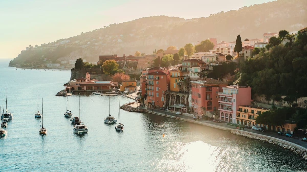
Nice and Menton have a reputation as seaside destinations — beaches, café terraces and strolls along the waterfront. That's true, and it's wonderful. But behind that first curtain lies an exceptional hinterland for hiking: hilltop villages just 30 minutes away by bus, historic trails overlooking the Mediterranean, and panoramas over Monaco you won't forget.
Better still, this coastal strip between Nice and Menton is one of the parts of France where you can hike comfortably all year. In November, when the beaches empty and temperatures drop in the mountain tourist zones, the Riviera remains mild, luminous and almost deserted.
Here are eight accessible routes, all doable without a car from Nice.
November on the Côte d'Azur: the Forgotten Season
Hikers who know the region will tell you: November may be the best month to walk between Nice and Menton. Daytime temperatures range between 12 and 20 °C — cool enough to walk without overheating, warm enough to never feel cold. Trails that are packed in July and August are almost deserted.
The mistral and autumn rains clean the air, and November light on the sea is particularly beautiful — that deep blue that Riviera photographers wait for all year.
Mont Boron and Mont Alban: Nice's Natural Balconies
Distance: 7 km | Elevation gain: +280 m | Level: Easy | Duration: 2h30
The Mont Boron massif is Nice's natural reserve — a green lung just minutes from the old port. From the Fort du Mont Alban (16th century), the view sweeps across the Bay of Angels on one side, and the Bay of Villefranche on the other.
The trail starts from the Mont Boron neighbourhood, accessible by bus from Place Masséna. The climb through the pine forest is gradual, the path well-marked. You pass the observatory before reaching the fort, open to visitors on weekends. The descent toward Villefranche along the corniche offers constant glimpses of the sea.
Best feature: the panorama from Fort du Mont Alban at golden hour — Nice's lighthouse to the left, Cap d'Ail to the right, and the Mediterranean turning shades of orange straight ahead.
Èze and the Nietzsche Path: an Iconic Descent
Distance: 7 km (round trip possible) | Elevation gain: +529 m | Level: Intermediate | Duration: 2h30
The Nietzsche Path is one of the most iconic routes on the Riviera. It takes its name from the philosopher who stayed at Èze-sur-Mer and walked up to the hilltop village — it's here he is said to have conceived parts of Thus Spoke Zarathustra.
The trail climbs from Èze-sur-Mer railway station (15 minutes from Nice by train) up to the medieval village of Èze, perched at 427 m altitude. The ascent is demanding — allow about 45 minutes of steady climbing — but the trail is well-maintained and shaded. The village of Èze, with its cobbled lanes and exotic garden, is worth the trip on its own.
From the village, the view over the sea is breathtaking. The Corniches d'Eze, curling their bends between sea and cliff, are visible from the castle belvedere.
View the Corniches d'Eze on OpenRando
Best feature: arriving in the village after the climb — medieval lanes with the Mediterranean 400 m below — a genuinely dizzying contrast.
La Turbie and the Trophy of Augustus: a Roman Detour
Distance: 5 km (loop) | Elevation gain: +180 m | Level: Easy | Duration: 1h45
La Turbie is the most overlooked village in this area, yet one of the most spectacular. Perched at 480 m altitude on the Grande Corniche, it houses the Trophée des Alpes, a Roman monument built in 7 BC to celebrate Augustus's victory over the Alpine peoples. It's the only monument of its kind preserved in France.
Access from Monaco or Nice is by bus. The loop from the village crosses the pine forest of the Tête de Chien, one of the finest viewpoints over Monaco — the principality appears below, squeezed between sea and rock like a full-scale model.
Best feature: the view over Monaco from the Tête de Chien, at 650 m altitude — on a clear day you can see as far as Corsica.
Sainte-Agnès: the Highest Coastal Village in Europe
Distance: 4 km (loop from the village) | Elevation gain: +150 m | Level: Easy | Duration: 1h30
Sainte-Agnès claims the title of highest coastal village in Europe — perched at 671 m altitude, it overlooks Menton and the sea just 5 km away as the crow flies. The view is extraordinary: you can simultaneously see the Bay of Menton, the Italian border, and the first spurs of the Alps.
The village itself deserves a slow exploration: medieval lanes, fountains, a fortified garden with a sheer drop below. The loop around the outskirts follows the ridgeline before passing the ruins of the Saracen castle.
Best feature: the gentle vertigo of seeing the sea from 671 m, with the rooftops of Menton below.
Gorbio: the Windmill Circuit
Distance: 5.5 km (loop) | Elevation gain: +220 m | Level: Easy | Duration: 2h
Gorbio is listed among the most beautiful villages in France for hiking. Clinging to its rocky spur at 360 m altitude, it has kept its medieval character intact: no cars, stone lanes, a bell tower and an old communal oven still used during the Corpus Christi procession.
The loop from Gorbio descends to the valley before climbing back via the ridge path. You pass the ruins of three windmills that once supplied the village with flour. Views over the sea and Menton's hills are constant.
Best feature: the coolness and quiet of the village off-season — in November you may meet a few locals, but almost no tourists.
Plateau Saint-Michel de Castellar: Menton's Balconies
Distance: 8 km | Elevation gain: +350 m | Level: Easy to intermediate | Duration: 3h
Castellar is the last French village before the Italian border. The trail climbs from the village to the Saint-Michel plateau, a protected wetland with 180° views over the sea, Italy and the Alps. The path then follows the Borna ridgeline, with panoramas alternating between the French and Italian coasts.
Best feature: the feeling of standing at the edge of France, with Italy in sight and the Mediterranean behind you.
The GR52 Toward Menton: a Full Day's Walk
Distance: 6.4 km (section) | Elevation gain: +614 m | Level: Strenuous | Duration: 3h
For walkers wanting something more physical, this final section of the GR52 offers one of the finest descents toward Menton on the entire coastline. The path alternates between pine forests, centuries-old olive trees and open views over Monaco and the Italian Alps.
View the GR52 section toward Menton on OpenRando
Best feature: arriving at Menton from above — the town, its orange rooftops and lemon trees, looks even more beautiful from the heights.
Getting There by Bus from Nice
This is the practical argument that makes this area one of the best for car-free hiking. The Lignes d'Azur network plus departmental bus lines serve all these points:
- Mont Boron: lines 14 and 32 from Place Masséna (Nice)
- Èze-sur-Mer: TER train Nice–Vintimille, stop Èze-sur-Mer (15 min)
- La Turbie: line 116 from Monaco or line 112 from Nice
- Menton: TER train (30 min from Nice) or express bus
- Sainte-Agnès: line 921 from Menton (25 min)
- Gorbio: line 921 from Menton
- Castellar: line 923 from Menton
What to Bring on These Hikes
These eight routes don't require technical equipment, but a few points are worth noting:
- Water: some villages have no easily accessible water point off-season. Set off with at least 1.5 litres.
- Sun protection: even in November, the Mediterranean sun can catch you out, especially on exposed ridges. A SPF50 sunscreen is still worth packing.
- Footwear: trails are mostly on stony paths. Hiking or trail shoes with good lateral support are preferable to trainers.
- GPX routes: all these trails are available on OpenRando Explorer. Download the GPX file before you go for offline navigation.
Coastal Hiking: a Riviera Art de Vivre
Between Nice and Menton, hiking isn't an austere sporting discipline — it's a way of seeing the landscape differently. The same views you admire from the Promenade des Anglais take on a completely different dimension when you're looking down at them from the ridgelines.
Discover more of our selection on the Mediterranean coastal trails to complete your walking exploration of the coast. And if you want to go further into the backcountry, the villages of the Haut-Var and the Verdon offer a striking contrast to this azure coastline.
The Côte d'Azur is as good for walking as it is for looking at. In November, it's even better.
As an Amazon Associate, we earn from qualifying purchases. Links marked with an external icon are affiliate links.
Related reading
Easy Hikes around Aix-en-Provence: Concors, Trevaresse and Arbois
Eight easy hikes around Aix-en-Provence beyond Sainte-Victoire: discover the Concors, Trevaresse, Arbois plateau and Vauvenargues hills.
The 10 Easiest Hikes in Bouches-du-Rhône
Discover the 10 easiest hikes in Bouches-du-Rhône: seaside walks, calanques viewpoints and Provençal panoramas accessible to all levels.
Easy Hikes in the Southern Alps: 8 Accessible Routes for All Levels
Discover 8 easy hikes in the Southern Alps: mountain lakes, picturesque valleys and stunning panoramas accessible to beginners and families. Routes, practical tips and GPX tracks.