The 10 Easiest Hikes in Bouches-du-Rhône
The Bouches-du-Rhône department is a permanent invitation to walk. Between the turquoise coves of the Calanques, the lagoons of Camargue and Crau, the golden hills of the Aix-en-Provence countryside and the windswept shores of the Étang de Berre, there is something for every taste — and especially for every fitness level.
These ten itineraries have been selected for their accessibility: short duration, gentle elevation gain, well-marked trails. Whether you are new to hiking, heading out with children, or simply prefer to stroll rather than sweat, you will find your next favourite easy hike in the Bouches-du-Rhône here.
1. Étang de l'Olivier — Istres
Distance: 2.8 km | Elevation: +14 m | Level: Very easy | Duration: 45 min
The gentlest walk on the list. The loop around the Étang de l'Olivier in Istres follows the shoreline through reeds and tamarisks. The almost completely flat surface makes it ideal for families with pushchairs and people with limited mobility.
In spring and summer, flamingos, herons and egrets settle along the water's edge. It is a haven of biodiversity a stone's throw from town, often overlooked by visitors passing through.
Highlight: the evening light on the lagoon when the pink reflections of flamingos blend with the clouds.
2. Calanque des Eaux Salées — Le Rouet
Distance: 4.1 km | Elevation: +90 m | Level: Easy | Duration: 1h15
In the heart of the Calanques National Park, this short loop leads to a discreet cove and a stunning view of the Rouet Viaduct. The path climbs gently along a limestone ridge before descending back to the sea, with shaded sections under Aleppo pines.
The Calanque des Eaux Salées sees far fewer visitors than its Marseille neighbours — a real privilege in high season.
Highlight: the sweeping view of the viaduct and deep blue sea from the ridge — an almost surreal setting.
3. Towards the Aiguille de Sormiou — Marseille
Distance: 4.5 km | Elevation: +238 m | Level: Easy | Duration: 1h30
From the Sormiou valley, this trail climbs to the rocky pinnacle towering above the famous calanque. The elevation gain is modest but the reward is spectacular: a 180° view over the emerald waters of Calanque de Sormiou, the Riou archipelago and, on clear days, the Frioul islands.
This is one of the finest introductions to the Calanques for beginner hikers. The trail is clearly marked and shaded mid-way.
Highlight: the natural lookout at the pinnacle, perched above one of the most beautiful calanques in the Mediterranean.
4. Corniche Promenade — Le Pharo, Marseille
Distance: 4.9 km | Elevation: +31 m | Level: Very easy | Duration: 1h15
The Corniche Promenade runs along the seafront between the Palais du Pharo and the Péron. This is Marseille's quintessential urban walk — almost flat, set to the rhythm of waves and the shouts of pétanque players. You stroll past the Vallon des Auffes with its colourful fishing boats, the rocky ledges where anglers try their luck, and the animated Sunday terraces.
This loop is perfect for easing into the season with legs still unaccustomed to hiking, or for enjoying a family sunset by the sea.
Highlight: photographs at sunset from the David statue, facing Marseille's harbour.
5. Chapelle Sainte-Réparate — Le Puy-Sainte-Réparade
Distance: 5.1 km | Elevation: +84 m | Level: Easy | Duration: 1h30
Far from the coastal crowds, this circuit through the hills north of Aix-en-Provence winds between holm oaks and lavender fields. The chapel of Sainte-Réparate, perched on a rocky spur, offers a serene view over the Durance plain and the first ridges of the Luberon.
The route unfolds in the tranquillity of an unspoilt Provençal landscape, free from coastal tourist pressure. Ideal for a midweek escape.
Highlight: the Romanesque chapel and the view over the Aix countryside — no roads, no noise.
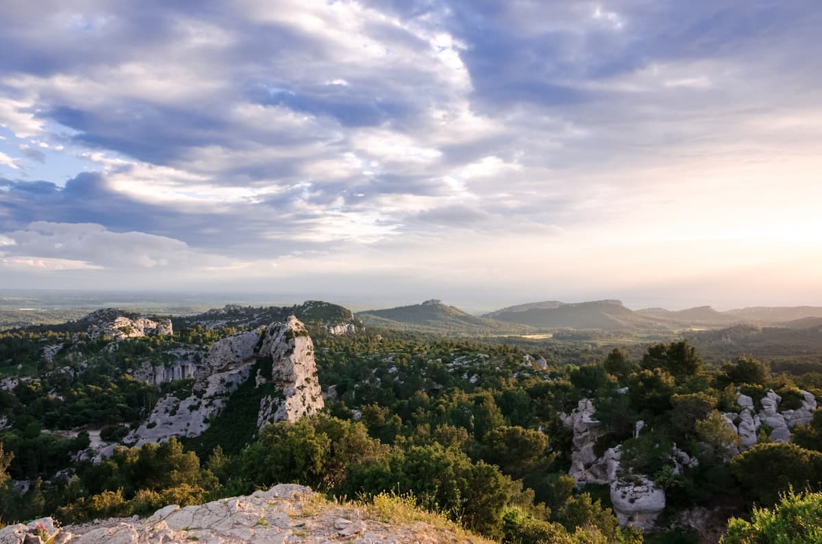
6. Lei Jaç Nòus Loop
Distance: 5.3 km | Elevation: +139 m | Level: Easy | Duration: 1h30
This little-known loop through the Crau hills offers immersion in the natural habitats of the Bouches-du-Rhône: garrigue scrubland, fallow fields and hedgerows. The elevation remains very gentle and the path is well-defined. A trail to breathe away from the crowds, appreciate the local flora and walk through a protected territory.
Highlight: the low vegetation that allows long views stretching all the way to the ridges of Sainte-Victoire.
7. Barrage de Bimont — Saint-Marc-Jaumegarde
Distance: 5.8 km | Elevation: +209 m | Level: Easy | Duration: 1h45
Built at the foot of Montagne Sainte-Victoire, the Bimont dam is one of the most photographed walking destinations in the Aix area. The intensely blue water contrasts with the white limestone and parasol pines. The trail circles the lake, alternating shade and sun, with spectacular views of the southern face of Sainte-Victoire.
This walk can be enjoyed in any season — always different depending on the water level and the time of day.
Highlight: the view from the dam wall onto the south face of Sainte-Victoire at sunset — a living Cézanne painting.
8. Port de Carro — Lavéra, Martigues
Distance: 6.0 km | Elevation: +31 m | Level: Very easy | Duration: 1h30
The Carro coast, northwest of Martigues, surprises with its white limestone cliffs and hidden coves — a far cry from the industrial image of the town. The trail hugs the coast almost entirely flat, with constant sea views and swimming spots in summer.
An ideal route for those unaccustomed to hiking in nature, with wide, easily walkable paths.
Highlight: the tiny Beaumaderie cove halfway along, a secluded beach perfect for a swimming break.
9. Balcon de Bibemus — Saint-Marc-Jaumegarde
Distance: 6.2 km | Elevation: +92 m | Level: Easy | Duration: 1h45
The ancient Bibemus quarries, whose ochre-orange blocks inspired Cézanne, offer a landscape straight out of a painting. This circuit above the Bimont reservoir crosses the abandoned quarries reclaimed by vegetation, then climbs to a viewpoint with a remarkable panorama over Sainte-Victoire and the Aix countryside.
The trail is accessible year-round and pleasant even in summer thanks to shaded sections under the pines.
Highlight: the quarries themselves, with their ochre limestone blocks that shift colour with the light.
10. View of Sainte-Victoire — Peynier
Distance: 6.6 km | Elevation: +91 m | Level: Easy | Duration: 2h
This circuit from Peynier crosses the forested hillsides facing Sainte-Victoire. The viewpoint is outstanding: the mountain carves into the horizon, the iconic symbol of Provence. The walk is peaceful, through pine forests and garrigue, with little elevation and a very accessible path.
It is one of the simplest ways to appreciate Sainte-Victoire without tackling the demanding trails of the massif itself.
Highlight: the panorama over Sainte-Victoire from the hillsides — a view Cézanne painted more than sixty times.
Preparing your hike in Bouches-du-Rhône
Heat: the great summer challenge
Summer in Bouches-du-Rhône can be brutal. To hike safely from June to September, a few precautions are essential:
- Set off early: before 9 am in July and August, the heat is not yet stifling.
- Hydrate regularly: aim for at least 0.5 L per hour of walking.
- Protect yourself from the sun: a hat, SPF 50 sunscreen and sunglasses are non-negotiable.
Calanques access restrictions
The Calanques National Park applies access restrictions during periods of high fire risk (June–September). Check the Park's website before each outing to find out which zones are open — certain areas can be closed without notice.
The essentials to bring
Even for a short easy walk, a few items make all the difference: enough water, a snack, your phone charged with the GPX track saved offline on OpenRando, and shoes with proper soles — no flip-flops or flat sandals on rocky paths.
The Bouches-du-Rhône department has dozens more trails for all levels. To go further, explore our selections:
- The 10 must-do hikes around Aix-en-Provence
- The most beautiful hikes in the Calanques of Marseille
- Hiking around Marseille: 10 trails beyond the Calanques
As an Amazon Associate, we earn from qualifying purchases. Links marked with an external icon are affiliate links.