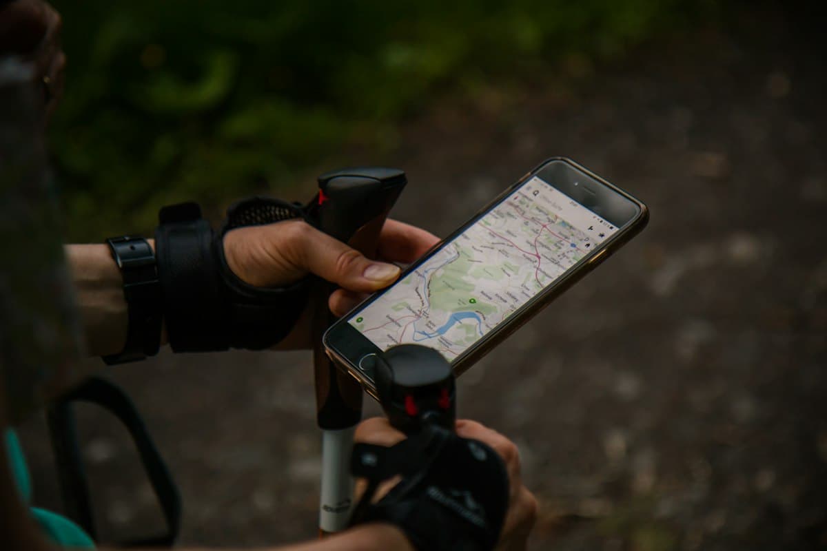
How to Plan Your Hike on OpenRando: The Complete Guide
Do you have a hike in mind but don't know where to start? Are you looking to explore an unfamiliar region, find a trail that matches your fitness level, or simply organise your next weekend outing without any unpleasant surprises? OpenRando is designed to guide you every step of the way — from finding a trail to getting back home safely.
This guide walks you through how to get the most out of the platform: discovering available hikes, reading a trail page in detail, creating your own custom route, and taking it with you even without an internet connection.
1. Search for a Trail by Area and Difficulty
The first step in good trip planning is finding the hike that suits you. On OpenRando, the Explore page gives you access to thousands of trails across France and neighbouring regions.
From the interactive map, you can zoom in on the area you're interested in — Provence, the Alps, the Massif Central — and see the available hikes appear. Each route is displayed directly on the map, giving you an immediate feel for the terrain.
The filters let you refine your search:
- Difficulty: easy, moderate, hard or very hard. OpenRando automatically calculates the difficulty level from the distance and elevation gain using a transparent formula.
- Distance: tailor the day's effort by filtering on mileage.
- Elevation gain: ideal if you are preparing for a demanding outing, or if you are looking for an accessible walk for children or beginners.
For instance, if you are planning to hike in the Alpilles, you will find moderate-difficulty loops such as the Panoramic Views Loop from Maussane-les-Alpilles — 5.7 km with only 83 m of elevation gain, perfect for a first taste of the massif.
For a more demanding adventure, the Calanques near Marseille offer trails like the Devenson Cliffs and Estret Ridge Loop — 11.6 km and 440 m D+, with spectacular views over the Mediterranean.
2. Reading a Trail Page
Once you have spotted a trail, click on it to access its full page. This is where you will find all the essential information before lacing up your hiking shoes.
The Elevation Profile
The elevation profile shows how the ascent is distributed throughout the route. You can identify sustained climbs, flat sections and descents. It is an invaluable tool for estimating your actual walking time and pacing your effort.
Key Statistics
Every trail page displays the essential data:
- Total distance in kilometres
- Positive (D+) and negative (D−) elevation gain
- Minimum and maximum altitude
- Calculated difficulty level
The Interactive Map
The route is overlaid on a topographic map. You can explore it, zoom in on tricky sections, identify key points of interest and understand the geographical context of the hike.
GPX Download
Every trail page lets you download the corresponding GPX file. This is the file you will load onto your navigation app to guide you on the ground — we cover this in more detail below. For a full explanation of how GPX files work, see our dedicated article: How to Use a GPX File for Your Hike.
3. Creating Your Own Route on the Map
OpenRando is not limited to sharing existing trails: you can also create your own custom route directly on the platform.
The route creation tool lets you:
- Drop waypoints on the map to draw your personalised itinerary
- Automatically calculate the distance, elevation and difficulty as you go
- Adjust the route by moving or adding waypoints
- Save your itinerary to your account so you can find it again easily
This feature is particularly useful if you are planning an outing in a poorly documented area, or if you want to link several trail sections together to create a bespoke circuit.
Once your route is created, you can export it as a GPX file to use on your mobile app or GPS watch. A GPS hiking watch lets you navigate without having to keep looking at your phone.
4. Exporting and Importing a GPX File
The GPX format is the universal standard for outdoor navigation. Knowing how to use it opens up every door — from mobile apps to dedicated GPS devices and smartwatches.
Exporting from OpenRando
From any trail page, click the download button to retrieve the corresponding .gpx file. This file contains the complete route with all its geographical coordinates.
Importing into Your App
Once the file is on your phone or computer, you can import it into:
- The OpenRando Mobile app (see the next section)
- Third-party apps such as Komoot, Wikiloc, AllTrails or Gaia GPS
- A dedicated GPS hiking device (Garmin, Suunto, etc.)
- A compact Garmin GPS for robust navigation without relying on your smartphone
For a step-by-step guide on using GPX files, see our dedicated article — it covers the detailed steps for each type of device.
5. The Mobile App and Offline Mode
OpenRando is available as a mobile app — essential for using your itineraries in the field, where connectivity is often limited or non-existent.
The app, available on iOS and Android, lets you:
- Navigate in real time along your GPX route
- See your position on the map, even without an internet connection
- Download maps for offline use for areas with no signal
- View the trail pages of hikes you have saved
How to Prepare Your Offline Download
Before heading out, especially in isolated areas like the Sainte-Victoire massif or the Gorges du Verdon, remember to:
- Open the app and browse to the area you are interested in
- Trigger the offline map download from the map settings
- Confirm that your route and its trail page are available offline
Also protect your phone with a waterproof hiking phone case — rain or a tumble into a stream can quickly end your navigation. And bring a lightweight power bank for long days on the trail.
The Croix de Provence — A Concrete Example
Take the Croix de Provence Loop from Saint-Antonin-sur-Bayon: 7.3 km and 538 m D+. This kind of hike, with exposed ridge sections, is exactly the type of outing for which offline access is essential. 4G coverage is often absent on the heights, and local GPS navigation becomes your only reference point.
6. Saving and Reviewing Your Outings
Using OpenRando does not stop when you return home. Once back from a hike, you can:
- Upload your recorded GPS track from your watch or app
- View your statistics: distance, elevation, average speed
- Compare your outings over time to track your progress
- Share your trails with the OpenRando community to enrich the catalogue
This community dimension is at the heart of OpenRando: every shared trail improves the experience for all other hikers. The routes you find on the platform today were created and validated by passionate people just like you.
Tips for Successful Planning
Before clicking "Start hike", a few habits to adopt:
- Check the weather the evening before and on the morning of your departure — conditions can change quickly in the mountains
- Plan your hydration: 500 ml of water per hour of walking is a good baseline. Bring a portable water filter for long outings
- Tell someone your itinerary and expected return time
- Carry a paper map alongside your GPS for hikes in isolated areas
- Check trail conditions: some massifs enforce summer access restrictions due to fire risk
OpenRando vs Other Hiking Apps
Unsure which tool to use for planning your hikes? Our comparison Best Hiking Apps 2026 helps you choose based on your needs — budget, features, offline availability.
OpenRando stands out for being free, having a rich database covering Provence and Southern France, and offering an interface designed for hikers of all levels. The web platform and the mobile app complement each other: plan on your computer from the comfort of your sofa, and navigate in the field from your phone.
Over to you. The next adventure starts with good preparation. Head over to OpenRando to explore thousands of available trails, create your own route, and head into the mountains with peace of mind.
As an Amazon Associate, we earn from qualifying purchases. Links marked with an external icon are affiliate links.
Related reading

How to Prepare for a Hike: The Complete Beginner's Guide
Discover our essential tips for preparing your first hike: gear, route planning, safety, and using GPX files. A complete A-to-Z guide.
How to Read and Use a GPX File for Hiking
Everything you need to know about GPX files: how to open them, follow them on your phone, and use them to never get lost on a hike.
Best Hiking Apps in 2026: Complete Comparison
Komoot, AllTrails, Wikiloc, IGN Geoportail, OsmAnd: which hiking app is best in 2026? Compared on maps, offline use, price and profile.