The Best Hikes in the Vosges Mountains
The Vosges mountains are one of France's most charming massifs — and one of the most overlooked by hikers from further afield. This ancient range, worn smooth by millennia of erosion, tops out at just 1,424 m at the Grand Ballon — but it holds its own against the Alps or Pyrenees for sheer landscape beauty, with a fraction of the crowds. In autumn, its vast beech forests turn copper and gold in a spectacle that ranks among France's finest seasonal displays. The highland meadows (called chaumes) at the summits offer panoramas stretching to the Alps on clear days, and the glacial lakes cupped in their cirques add a Scandinavian touch that feels unlike anywhere else in France.
The Vosges also have a unique selling point: the waymarking system of the Club Vosgien, France's oldest hiking club, which invented a trail-marking system entirely different from the national standard — and it works beautifully. More on that below.
Here is our selection of the 8 best hikes in the Vosges, from the Hohneck to the Grand Ballon, via the Lac Blanc, Lac Noir and the ridge route known as the Route des Crêtes.
The Vosges in Autumn: Beech Forest Season
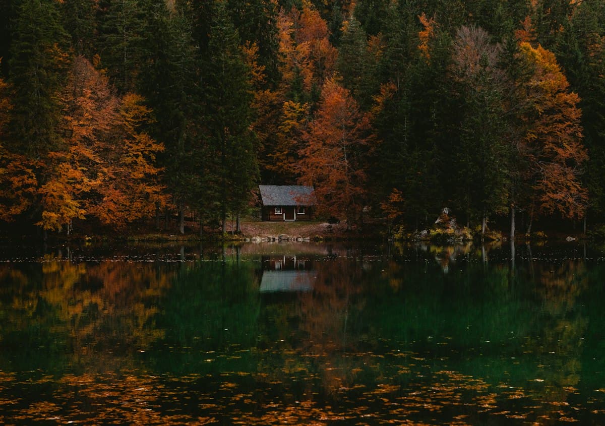
Autumn is undeniably the best season to hike the Vosges. From mid-October to mid-November, the beech forests covering the slopes between 600 and 1,100 m elevation transform into a blaze of colour. Beech dominates — it accounts for over 60% of the Vosges tree cover — and its leaves shift in a matter of weeks from pale yellow to intense gold, then to copper and russet. Maples and rowans add their own notes of orange and red.
The low autumn light, warm and raking, brings out these tones better than any other season. Misty mornings in the valleys, followed by clear skies on the ridges, create exceptional photographic conditions. The temperatures stay comfortable for hiking (5–15 °C at altitude by mid-afternoon) and crowds drop sharply from the summer peak, especially on the ridges and cols. Pack waterproof boots — forest trails stay damp throughout autumn.
For a broader guide to France's top autumn colour destinations, see our article on Where to See the Best Autumn Colours in France.
The Hohneck and the Route des Crêtes
1. Hohneck Loop from Schiessrothried Lake
View the OpenRando trail — Hohneck Loop — 14.2 km, 620 m elevation gain
The Hohneck (1,363 m) is the third-highest peak in the Vosges and the most iconic summit on the Alsace side. Its bare dome, swept by westerly winds, offers on clear days a panorama spanning Alsace, the Black Forest, the Jura and the Bernese Alps. It is also the ideal introduction to the atmosphere of the Vosges chaumes — these windswept summit meadows covered with bilberries and gentians in summer, ochre and golden in autumn.
This loop from Schiessrothried lake follows the GR53 up to the Kastelberg before reaching the Hohneck summit. The descent along the Frankenthal crest crosses a landscape of granite boulders (Felsenmeer) typical of Vosges geology before dropping back to the glacial lake. The view down onto the lake from the crest path alone is worth the trip.
Level: intermediate | Duration: 4–5 h | Start: Schiessrothried lake car park
2. Crête Traverse: Col du Herrenberg to the Markstein
View the OpenRando trail — Herrenberg Highland Traverse — 11.8 km, 380 m elevation gain
This linear hike follows the crest of the Route des Crêtes — a road built by the French military in 1914–1918 to keep supply convoys hidden from German-occupied Alsace below. The hiking trail alongside it offers alternating views of both slopes: to the east, the Alsace plain and the Black Forest; to the west, the rolling Lorraine plateau.
In autumn, the chaumes turn golden, contrasting with the dark green of the spruce forests below. Vosges sheep grazing the high pastures into October add a pastoral element to the ridge atmosphere. This hike requires a shuttle car between the two cols, or a return along the Route des Crêtes road.
Level: easy | Duration: 3–4 h | Start: Col du Herrenberg
The Grand Ballon
3. Grand Ballon Loop from Goldbach-Altenbach
View the OpenRando trail — Grand Ballon from Goldbach — 16.5 km, 720 m elevation gain
The Grand Ballon (1,424 m) is the highest point of the Vosges. Its summit, crowned by a memorial to the Chasseurs Alpins and a military radar sphere, is not the wildest spot in the range — but the view is unbeatable. On a clear autumn day, Alsace unfolds below like a relief map: vineyards, the Rhine plain, Colmar, Mulhouse, and beyond the silver ribbon of the Rhine, the Black Forest hills.
This loop from Goldbach-Altenbach is far wilder than the direct ascent from the col. It crosses thick beech forests on the Lorraine side, skirts upland peat bogs before emerging onto the summit chaumes, and descends through the Alsatian slope with plunging views over the Guebwiller vineyard. Bring trekking poles for the sustained descent on the eastern flank.
Level: intermediate | Duration: 5–6 h | Start: Goldbach-Altenbach
4. Vieil Armand Ridgeline and Memorial
View the OpenRando trail — Hartmannswillerkopf — 9.3 km, 480 m elevation gain
The Hartmannswillerkopf (Vieil Armand) is one of the most historically significant summits in the Vosges. This 956 m peak was bitterly contested throughout the First World War, and its very landscape still bears the marks: trenches, shelters and shell craters line the trail. The Franco-German national memorial opened in 2017 has made it a site of remembrance well worth visiting.
But the Vieil Armand is also a fine hike in its own right, with exceptional views over the Alsace plain and the Grand Ballon. In autumn, the surrounding chaumes and early beech forests create a landscape of great beauty, strikingly contrasted with the solemn character of the site.
Level: easy to intermediate | Duration: 3 h | Start: memorial car park
The Glacial Lakes: Blanc, Noir, Longemer
5. Lac Blanc from the Col du Wettstein
View the OpenRando trail — Lac Blanc — 12.4 km, 550 m elevation gain
The Lac Blanc is one of the most photographed sites in the Vosges — and rightly so. Framed by granite cliffs and fir forests, this glacial lake at 1,054 m reflects in autumn the russet tones of the surrounding larches in its dark waters. The path around it — the Chemin des Crêtes du Frankenthal — dominates the lake from the northern cliffs before dropping into the beech woodland on the southern side.
The loop can be extended to the Lac Noir (an hour's additional walk), smaller and wilder, nestled in a rocky cirque with no road access. The two lakes together make for a classic Alsatian Vosges excursion.
Level: intermediate | Duration: 4 h | Start: Col du Wettstein
6. Tour of Lac de Longemer and Retournemer
View the OpenRando trail — Longemer and Retournemer Lakes — 13.7 km, 420 m elevation gain
On the Lorraine side of the Vosges, the Lac de Longemer (1.3 km long) and the Lac de Retournemer form a string of glacial lakes in a setting of mixed forests and meadows. This corner of the Vosges is less visited than the Alsatian side, and the trails are often empty outside summer.
The loop connecting the two lakes via the wooded heights crosses spruce forests typical of the Lorraine Vosges, where autumn colours are gentler but equally appealing. A stop at the ferme-auberge de Retournemer is essential to try warm Munster cheese and local kirsch.
Level: easy | Duration: 4 h | Start: Lac de Longemer car park
The Club Vosgien Waymarking System: France's Oldest, Most Distinctive
One of the most interesting particularities of the Vosges for any hiker: the Club Vosgien, founded in Strasbourg in 1872, is France's oldest hiking club. Over the decades it developed a trail-marking system entirely different from the standardised GR (red-white) and PR (yellow) blazes found across the rest of France.
The Club Vosgien uses geometric shapes painted on trees and rocks: red rectangle, blue circle, yellow triangle, red diamond, red disc, and so on. Each symbol corresponds to a route type and a difficulty level codified in the Club's guide books. The system is extraordinarily dense: the Vosges massif has more than 16,000 km of Club-marked trails — one of the most developed foot-trail networks in Europe.
The coexistence with the national GR waymarking can be confusing at first — you sometimes find both systems on the same stretch. But once you understand the logic of the Vosges geometric shapes, you appreciate their clarity in the field, especially for local loops that don't follow the GR.
For a complete guide to France's trail-marking systems — from GR to PR and regional exceptions like the Club Vosgien — see our detailed article: Understanding France's Trail Waymarking Systems.
Farm Inns and Marcairies: The Vosges on a Plate
7. Farm-Inn Circuit from Munster
View the OpenRando trail — Munster Farm-Inn Circuit — 18.2 km, 780 m elevation gain
The Munster valley, carved into the Alsatian Vosges, is the birthplace of Munster cheese — one of France's oldest, produced here since the 9th century. The fermes-auberges (mountain farm inns, called marcairies in Alsatian dialect) that dot the chaumes are essential stops on any Vosges hike.
A marcairie is a summer dairy farm where Vosges cattle graze the high pastures. Cheeses are aged on site, and the restaurants serve generous mountain cuisine: mountain choucroute, tarte flambée, Vosges meat pie, warm Munster cheese on potatoes. This circuit from Munster links several farm inns via ridges and intermediate beech forests.
Level: intermediate to strenuous | Duration: 6–7 h | Start: Munster
8. Tanet and Gazon du Faing Traverse
View the OpenRando trail — Tanet and Gazon du Faing — 10.5 km, 430 m elevation gain
The Tanet and Gazon du Faing are two secondary summits between Lac Blanc and the Hohneck on the main Vosges crest. Their chaumes protect rare sphagnum peat bogs classified as a nature reserve. In autumn, the bilberries turn deep purple, contrasting with the blond grasses.
This linear hike from Stosswihr is one of the wildest on the Alsatian side — you encounter very few people outside summer. The view from Gazon du Faing over Lac Blanc and the Frankenthal cliffs is one of the finest panoramas in the entire Vosges massif.
Level: intermediate | Duration: 3–4 h | Start: Stosswihr
Practical Information
Getting there: Colmar (Alsace side) and Épinal or Gérardmer (Lorraine side) are the main gateways. Buses connect Colmar to the main cols in summer (route 101 «Route des Vins»).
Maps: IGN 1:25,000 maps cover the entire massif. Club Vosgien guide books are a useful complement, available at club-vosgien.com.
Accommodation: Gérardmer (Lorraine side) and Munster (Alsace side) are the main bases. Farm inns often offer simple but authentic dormitory lodging.
Best season: September to November for autumn colour. December to March for snowshoeing. July–August for family walks to the lakes.
As an Amazon Associate, we earn from qualifying purchases. Links marked with an external icon are affiliate links.
Related reading
The Most Beautiful Hikes in the Jura Mountains
Vertiginous reculées, tufa waterfalls, glacial lakes, fir forests… Discover our selection of the 8 most beautiful hikes in the Jura, with detailed routes, difficulty levels and practical tips to explore this underrated massif in northeastern France.
Hiking Around Lac de Serre-Poncon: 8 Trails
Pic de Morgon, Aiguilles de Chabrieres, Sentier des Pyramides: eight hiking trails around France's largest reservoir, in the southern Alps.
Hiking During Hunting Season: How to Stay Safe in Autumn
How to hike safely during hunting season in France: know the hunting dates by region, how to spot an active drive hunt, how to stay visible, and what to do if you encounter a battue.