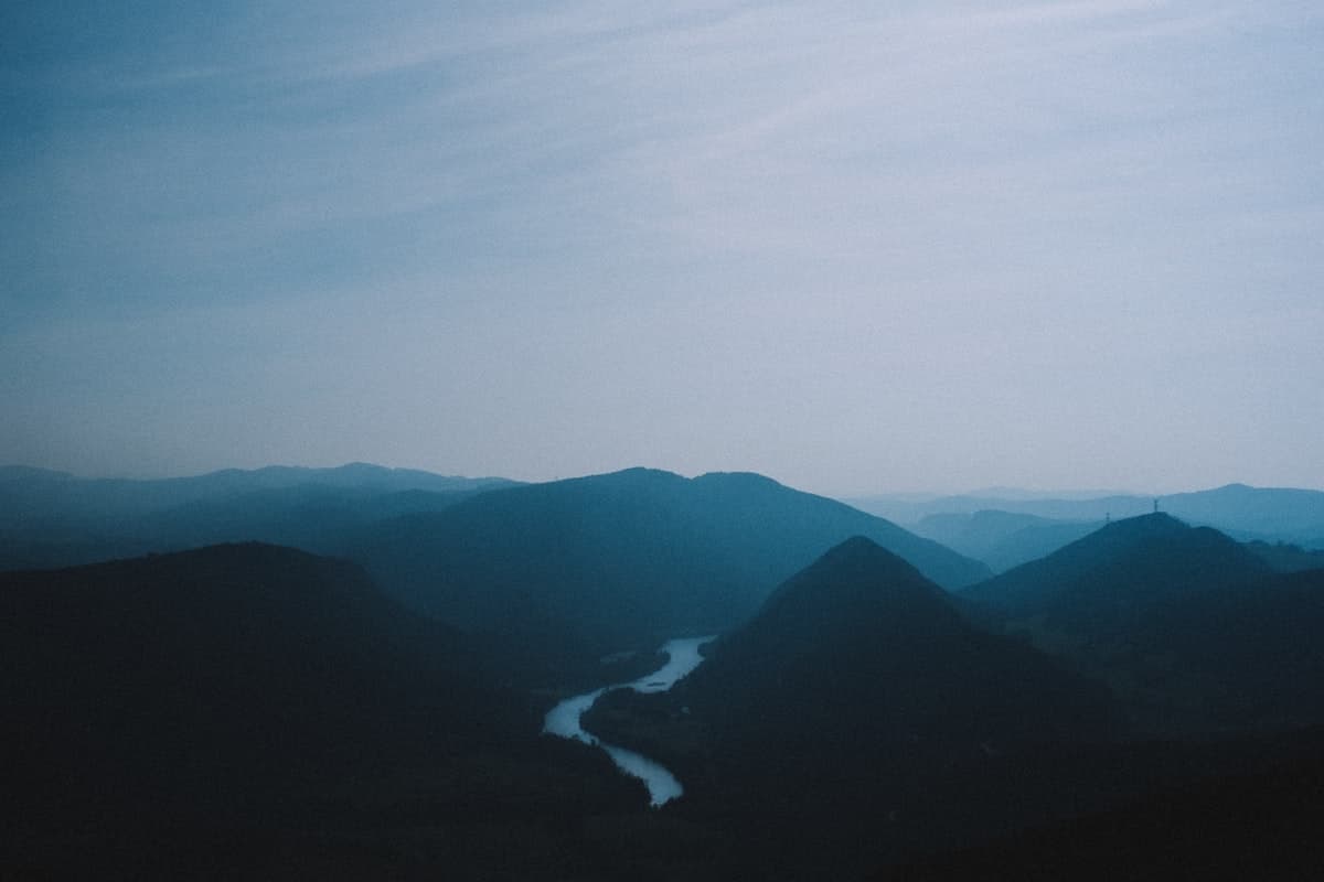
The Most Beautiful Hikes in the Jura Mountains
The Jura is one of France's most captivating and least-visited mountain ranges. Nestled between Burgundy, Alsace and Switzerland, this limestone plateau sculpted by glaciers and underground rivers harbours landscapes that rival the Alps or Pyrenees — with far fewer crowds. Ubiquitous conifer forests, plateaux dotted with dolines, vertiginous reculées (blind valleys), tufa waterfalls with their organic shapes, turquoise glacial lakes: the Jura is an exceptional playground for hikers seeking unspoiled nature.
Here is our selection of the 8 most beautiful hikes in the Jura, from Lac de Saint-Point to the reculées of Arbois, taking in the mythical springs of the Loue and viewpoints over the Alps.
Why Hike in the Jura?
The Jura offers an extraordinarily varied palette of landscapes across a relatively compact territory. Within a few kilometres of walking, you can move from a silent fir forest to a sheer limestone cliff dropping into a reculée — those dead-end valleys at whose base a river sometimes emerges from a resurgence spring. The massif's karstic geology is responsible for its most spectacular curiosities: caves, vauclusian springs, tufa waterfalls (those calcite concretions that give waterfalls a uniquely sculpted, otherworldly form).
The temperate continental climate, moderated by altitude (400 m to 1,720 m at Crêt de la Neige), provides pleasant hiking conditions from May to October. In summer, forests provide welcome shade and lakes allow for a refreshing swim at the end of a route. Autumn is arguably the most beautiful season: beech forests turn red and gold, morning mists cling to the bottom of reculées, and raking light magnifies the limestone cliffs.
The Jura is also a celebrated wine region — vin jaune from Arbois, crémant du Jura, Comté and Morbier cheese naturally accompany trail picnics. A hike in the Jura is as much a gastronomic experience as a sporting adventure.
The 8 Most Beautiful Hikes
1. Source de la Loue Loop from Ouhans
View the OpenRando route — Source de la Loue Loop — 19.3 km, 708 m elevation gain
This is one of the Jura's most impressive natural curiosities: the Source de la Loue, at the foot of the Ouhans cliff, sees an entire river surge from a 30-metre-wide chasm. In 1901, an accidental flood at the Pernod distillery in Pontarlier proved that the Loue is actually a resurgence of the Doubs, which seeps into the limestone plateau several kilometres upstream before reappearing here with tremendous force.
This loop from Ouhans follows the source then climbs the wooded Loue gorge on a steep path offering vertiginous drops to the turquoise river below. The return route across the plateau reveals the flower-filled meadows typical of the massif and Comtois farmhouses with their stone-tile roofs. Wear shoes with good grip — the damp paths alongside the Loue can be slippery.
Level: intermediate | Duration: 5–6 h | Start: source car park, Ouhans
2. Lac de Saint-Point via Source Bleue
View the OpenRando route — Lac de Saint-Point via Source Bleue — 19.6 km, 405 m elevation gain
Lac de Saint-Point is the largest natural lake in Franche-Comté (360 hectares, 7 km long) and one of the most beautiful in the Jura range. This hike from Les Granges-Sainte-Marie follows the GR595 to the Source Bleue — a resurgence spring with strikingly blue-green waters, fed by infiltrations from the Malbuisson plateau — before joining the lake shore for an out-and-back to Fort Saint-Antoine.
Fort Saint-Antoine is now home to the cheese caves of affineur Marcel Petite, where more than 100,000 Comté wheels mature in cool, humid cellars. Visiting can complement the hike for a full immersion in Comtois culture. A cool insulated bottle will be appreciated during the open-plateau sections in full sun.
Level: easy to intermediate | Duration: 5 h | Start: Les Granges-Sainte-Marie
3. Fer à Cheval Viewpoint and Tufa Waterfalls — Arbois
View the OpenRando route — Fer à Cheval Viewpoint / Tufa Waterfalls — 19.4 km, 365 m elevation gain
Arbois — Louis Pasteur's birthplace and the capital of Jura wines — is surrounded by a spectacular reculée, one of the most accessible in the massif. The Arbois reculée is a U-shaped valley whose limestone cliffs rise over 100 metres, threaded by the Cuisance river which is born from several springs at the bottom of the cirque.
This loop climbs to the Fer à Cheval viewpoint, perched on the cliffs that dominate the reculée from their full height. The view down into the cirque and over the Arbois vineyards terraced on the slopes is breathtaking. The descent passes the tufa waterfalls — cascades enveloped in organic calcite formations, moss-covered and green, looking as if they belong in a fantasy landscape. With very modest elevation gain, this route is accessible to beginner hikers.
Level: easy | Duration: 4–5 h | Start: Arbois town centre
4. Reculée des Planches and Fer à Cheval Viewpoint
View the OpenRando route — Reculée des Planches — 19.2 km, 553 m elevation gain
Neighbouring the Arbois reculée, the Reculée des Planches-près-Arbois is wilder and less visited. It is home to the Grotte des Planches, threaded by the underground Areuse river, and magnificent waterfalls in wooded surroundings. This loop from Les Planches-près-Arbois explores the valley floor before climbing onto the plateau via an exposed path offering plunging views.
The Fer à Cheval viewpoint — accessible from both reculées — is one of the Jura's most iconic vantage points. On a clear day, the view extends to the Alps and Mont Blanc. Bring trekking poles: the ascent to the plateau on sometimes-steep limestone paths is more comfortable with added support.
Level: intermediate | Duration: 5–6 h | Start: Les Planches-près-Arbois
5. Lac des Lésines and Planachat Viewpoint
View the OpenRando route — Lac des Lésines and Planachat Viewpoint — 19.2 km, 562 m elevation gain
This loop explores one of the massif's most secret sectors. Lac des Lésines is a narrow, elongated lake nestled in a wooded valley, sheltered from any road. The surrounding vegetation — reed beds, willows, ash trees — makes it a paradise for water birds. Patient observers may spot grey herons, great crested grebes and, in summer, the occasional little egret.
The Planachat viewpoint offers one of the finest views of the Clairvaux lakes and their wooded islands, with the hills that herald the Revermont in the background. The hike weaves through deciduous forests, valley-floor meadows and open limestone ridges — a fine variety of landscapes for a reasonable amount of ascent.
Level: intermediate | Duration: 5 h | Start: Lac des Lésines car park
6. Tour du Lac de Saint-Point from Malbuisson
View the OpenRando route — Tour du Lac de Saint-Point — 19.3 km, 213 m elevation gain
The tour du lac de Saint-Point is the ideal hike for a relaxed family day. With only 213 m of cumulative elevation gain over 19 km, the route follows both shores of the lake, alternating forested sections, wet meadows and quiet lanes. The lake itself is magnificent, framed by Montbéliard cow pastures and fir forests.
From Malbuisson, a lively lakeside resort in summer, the path circles the entire lake with constantly renewed views over the water. In June, wild orchids bloom in the damp lakeside meadows. In September, morning mists rise slowly from the lake for remarkable photographic light. This hike is perfectly suited to beginners and families with children aged 6 and over.
Level: easy | Duration: 4–5 h | Start: Malbuisson
7. Source des Fonteniaux and Two-Lakes Viewpoint
View the OpenRando route — Source des Fonteniaux and Two-Lakes Viewpoint — 19.5 km, 450 m elevation gain
This loop from Malbuisson combines two curiosities of the lakes plateau: the Source des Fonteniaux, a karstic resurgence that feeds Lac de Remoray (a national nature reserve), and the Two-Lakes viewpoint, which provides an exceptional panorama over Lacs de Saint-Point and Remoray stacked in their forested setting.
The Lac de Remoray nature reserve is one of Franche-Comté's most important wetlands. It shelters rare species: the great crested newt, the European otter (difficult to spot but well established), and breeding common terns. Compact binoculars will allow you to appreciate the wildlife richness of this area without disturbing its tranquillity.
Level: intermediate | Duration: 5 h | Start: Malbuisson
8. Aiguilles de Baulmes and Jura Viewpoint
View the OpenRando route — Aiguilles de Baulmes and Jura Viewpoint — 19.4 km, 1,176 m elevation gain
This is the most demanding hike in our selection — and arguably the most rewarding. The Aiguilles de Baulmes are limestone rock pinnacles that dominate the Swiss plain from a ridge at over 1,500 m altitude. From Baulmes, a small Swiss town at the gateway to the Jura massif, the ascent to the ridge is long and sustained (1,176 m D+), but it opens onto a breathtaking panorama: to the north, Lac de Neuchâtel and the Bernese Alps; to the south, Lake Geneva and Mont Blanc; to the west, the immensity of the French Jura plateau.
This demanding hike requires proper equipment: waterproof high-ankle mountain boots, warm layers for the summit (constant wind on the ridge even in summer), and plenty of water as there are no supply points in altitude. Save this outing for a day of stable, clear weather.
Level: difficult | Duration: 7–8 h | Start: Baulmes (Switzerland)
When to Hike in the Jura?
- May–June: ideal for wild flowers (yellow gentian, orchids), waterfalls in full flow and still-moderate crowds.
- July–August: moderate heat on the plateaux (10–20°C at altitude), swimming possible in the lakes. Some afternoon thunderstorms on the ridges.
- September–October: the best light, autumn colours, hunting season begins (wear a bright orange vest and avoid open spaces in early morning).
- November–April: snow possible above 700 m. Trails remain accessible on snowshoes or cross-country skis, but some viewpoints can be icy.
Recommended Kit for the Jura
The Jura has a mountain feel despite its modest altitude. Conditions can change quickly, especially on the ridges. Always bring:
- A lightweight waterproof jacket even in fine weather: plain thunderstorms can build quickly.
- Shoes with good grip: clay-limestone paths are treacherous after rain.
- Plenty of water: springs on the plateaux are scarce, as water percolates through the limestone.
- An IGN 1:25,000 map or the GPX track downloaded to your navigation app before you leave.
Explore the Jura with OpenRando
All the hikes featured here are available on OpenRando with GPX tracks, elevation profiles and field photos. The app lets you download routes for offline use — essential in gorges and reculée floors where mobile signal is non-existent.
You can also browse our guides to hiking in the Gorges du Verdon or the most beautiful hikes in the Pays Basque to plan your next adventures.
As an Amazon Associate, we earn from qualifying purchases. Links marked with an external icon are affiliate links.
Related reading
The Best Hikes in the Vosges Mountains
Eight hikes in the Vosges: summits, glacial lakes, highland meadows and ridge trails, through France's most spectacular autumn beech forests.
Hiking Around Lac de Serre-Poncon: 8 Trails
Pic de Morgon, Aiguilles de Chabrieres, Sentier des Pyramides: eight hiking trails around France's largest reservoir, in the southern Alps.
8 Hiking Trails Around Lac de Sainte-Croix
Eight loops of all levels around Lac de Sainte-Croix, between Bauduen, Moustiers and Esparron, at the gates of the Verdon gorges.